
Barrier Tracker app will be translated into 9 languages
January 11, 2018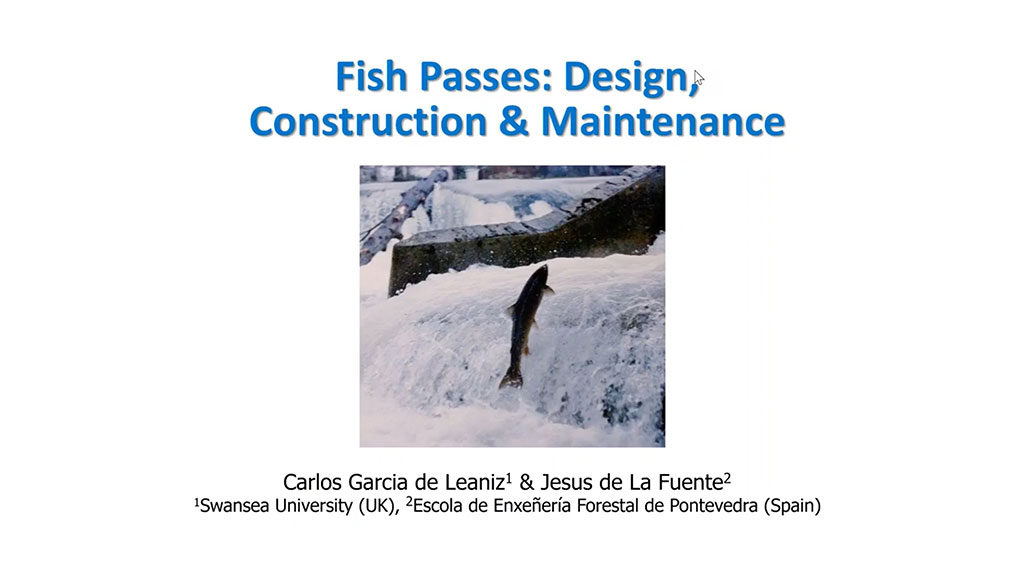
Fish passes: design, construction & maintenance
February 16, 2018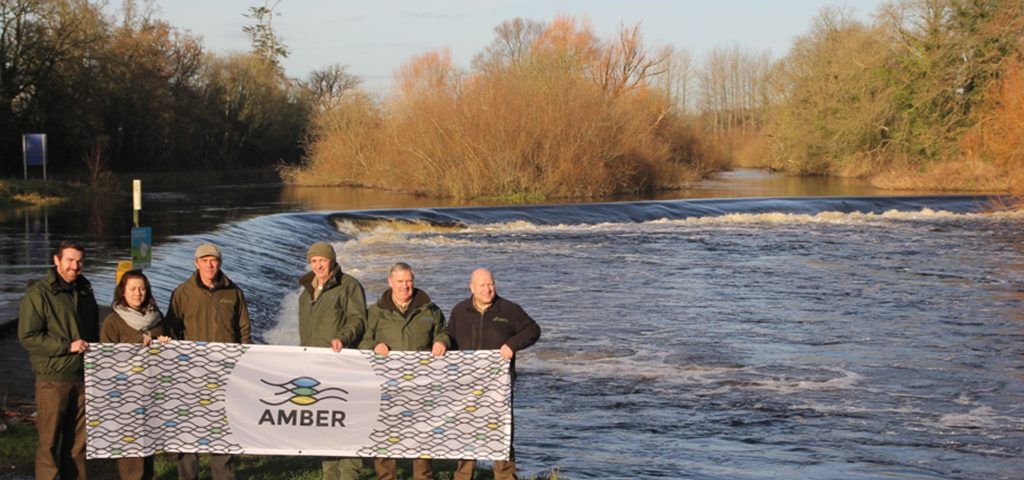

Barrow Catchment Barrier Assessment
The River Barrow is Ireland’s second longest river after the River Shannon. It is approximately 192km in length from source to sea, the catchment draining a total area of 3,025km². The Barrow catchment is underlain in its flat northern area by limestone. In the narrower, southern part of the catchment, granites dominate, culminating in the summits of the Blackstairs Mountains. The main river has approximately 65km of navigable waterways and as result there are a significant number of large weirs along the main stem of the river to aid navigation. The main channel, including the estuary and many of its sub-catchments are located within the River Barrow and River Nore Special Area of Conservation (SAC) under the EU Habitats Directive. The SAC is of considerable conservation significance for habitats and plant and animal species that are listed on Annexes I and II of the EU Habitats Directive. Among the Annex II species listed in the Barrow SAC are the Atlantic salmon, the sea- and river lamprey and the Twaite shad. These are migratory species, with adult fish entering from the sea to spawn in the freshwater system. All can travel long distances upstream in catchments and their upstream movement and ability to fully colonise catchments is influenced by man-made barriers. Inland Fisheries Ireland undertook a catchment wide barrier survey on the River Barrow catchment which was completed in December 2017. The main aim of the survey was to create a digital layer of barriers in the Barrow catchment, in particular their location, type & dimensions (barrier height, water depth etc.) and thus quantify the impact on fish migration. The project began in 2015 and the AMBER project was a major driver in continuing the project in 2016 and completing it in 2017.Barrier Identification
IFI has a two-step approach to catchment wide barrier surveying. Step 1 involves putting ‘spots-on-maps’ i.e. to identify potential barrier locations using ArcGIS tools with aerial images and historic maps. This allows the surveyor to compile basic information on these structures. The desk-based procedure provides a rationalised ‘road map’ for a survey team to go out into an area and view all locations marked as potential barriers. Step 2 then involves surveying structures considered to be ‘barriers’ within the channels based on the initial visual assessment on the day of the survey. On-site data is recorded on ruggedized laptops or ‘tablets’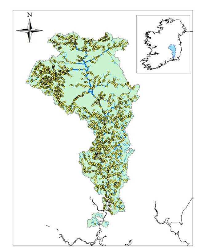
Fig: Potential barriers in the Barrow catchment (n=2928)
Barrow sites
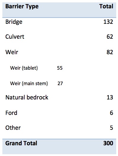
The desk based analysis for the Barrow revealed a total of 2928 potential barriers throughout the catchment. The potential sites were visited by 2-person survey teams. In total 300 barriers were recorded over the duration of the survey, ranging from barriers on 1st order streams to main stem 6th order. 273 barriers were recorded on the tablet with a mean barrier height of 0.33m. There were a further 27 large barriers, the navigation weirs, on the main stem (>1m drop height) which were noted as barriers. The majority of structures were categorised in the bridge category (bridge footing and bridge apron) (n=132) along with weirs (n=82) and culverts (n=62).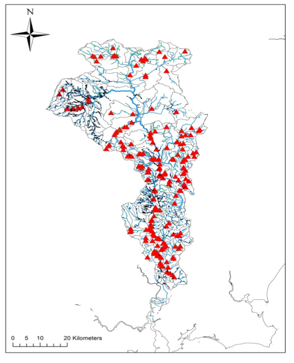
Fig: Barriers on the barrow
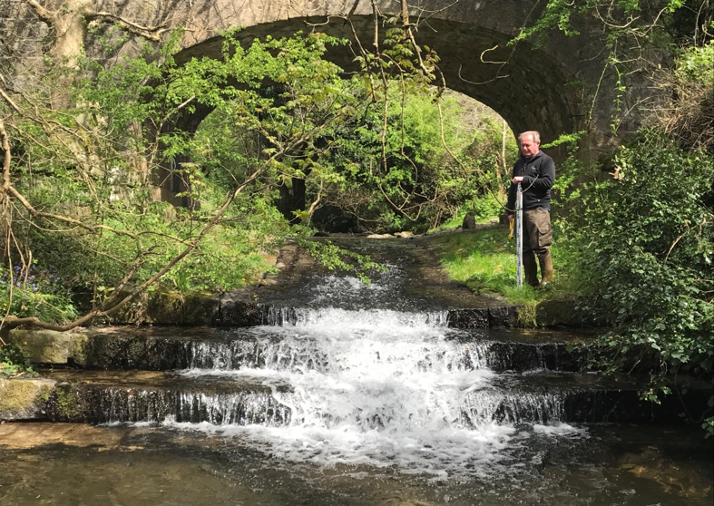
Bridge apron with vertical steps
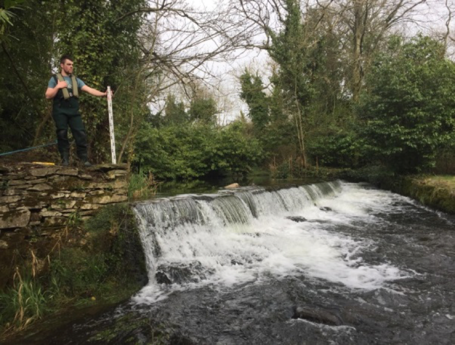
Weir
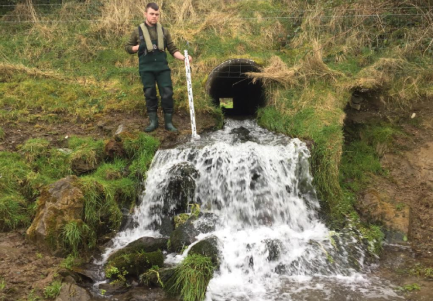
Culvert
Conclusion
The Barrow is an important leisure angling fishery and is described as a ‘mixed fishery’ – with quality angling for pike, salmon and coarse fish species in the main channel and extensive brown trout waters in the tributaries, This survey has provided information on barrier distribution and potential impacts on migratory and resident fish species - brown trout, Atlantic salmon, sea lamprey, coarse fish species and pike within the catchment. The ‘total’ approach to viewing all potential barriers will guide IFI in developing ‘rules’ or cut-off criteria for undertaking barrier surveys in further catchments. • These data have the potential to feed directly into a number of AMBER work packages. The IFI team has used some of the data in a comparative study of the SNIFFER (UK) and ICE (Fr) barrier assessment protocols –which the team presented at the Fish Passage 2017 conference in Corvallis, Oregon. • collaborative efforts are currently underway to assess the ‘tablet’ data collection process as a basic universal and to write programme code to match the ‘tablet’ with ICE • It is envisaged that this work will aid IFI in making informed barrier prioritization decisions at the catchment level The IFI team, consisting of colleagues from IFI R&D and from Southeastern River Basin District wrapped up the final barrier assessments with an AMBER photo opportunity and a well-earned coffee just before Christmas in Carlow, in the heart of the catchment.
Fig Large weir and navigation channel on the main stem of the barrow in Carlow town.
