SUDOANG
The abundance of the European eel (Anguilla anguilla) has been declining in the last 50 years and is outside safe biological limits, which guarantee the survival of the species. SUDOANG will provide managers with common tools and methods that contribute to the conservation of the European eel and its habitat in the SUDOE area.Greater Thames Estuary Fish Migration Roadmap
To address the issue of river fragmentation and fish migration within the greater Thames estuary area, the Thames Estuary Partnership (TEP) and Nature at Work (NAW) launched the Greater Thames Estuary Fish Migration Roadmap project in 2018. The project aims to pull together all barrier, pass, priority, and habitat location data in one place and help to develop a strategic approach that aims to improve rivers as migratory routes that fish would use. This sea-to-source method follows fish species at every step of their migration from sea to river and vica versa and enables the visualisation of river connectivity in entire catchments. The Roadmap provides a blue print for decision makers to find which barriers need to be prioritised to carry out river restoration, riverside development and flood mitigation works.FIThydro
FIThydro addresses the decision support in commissioning and operating hydropower plants (HPP) by use of existing and innovative technologies. It concentrates on mitigation measures and strategies to develop cost-efficient environmental solutions and on strategies to avoid individual fish damage and enhancing population developments. Therefore HPPS all over Europe are involved as test sites.
MARS
MARS is a research project and supports European policies, such as the Water Framework Directive, and the Blueprint to Safeguard Europe’s Water Resources. We have two target groups: "water managers" assessing and restoring rivers and lakes; and policy makers drafting and implementing policies related to water. Our main objectives are: to understand the effects of multiple stressors on surface waters and groundwaters, their biota, and the services they provide to humans, to understand how ecological status and ecosystem services are related – if at all, to advise river basin management how to restore multiply stressed rivers and lakes, to advise the revision of the Water Framework Directive on new indicators for ecological status and ecosystem services and to develop methods and software for the Programmes of Measures
RECONNECT
RECONNECT is harnessing knowledge on the distribution, types and impacts of barriers on Irish rivers, and is developing a validated methodology for identifying the locations of barriers and prioritising their modification or removal to improve hydromorphology and connectivity in Irish rivers. The project results will advance efforts to improve the physical and ecological integrity of Ireland’s rivers and will inform the choice of measures to address policy requirements.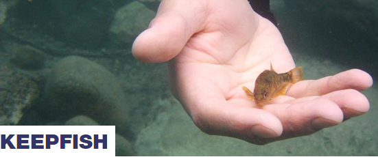
KEEPFISH
KEEPFISH aims to improve the passage of vulnerable fish species through river barriers in temperate regions of the southern hemisphere currently experiencing rapid hydropower development. This will be achieved through the following objectives: Gather and synthesise generic transferable knowledge, empirical data and expert judgement to predict passage of vulnerable fish species through river barriers, Identify key uncertainties and knowledge gaps, Train biologists, engineers and interdisciplinary workers in state-of-the-art methods required to reduce uncertainties and fill knowledge gaps, In consultation with stakeholders, develop systematic research strategy for fish passage research in the temperate south and Raise public awareness and influence research and policy.
Dam Removal Europe
Dam Removal Europe has the ambition to restore rivers in Europe, which used to be of high natural or cultural importance by removing dams in order to have once again healthy free-flowing rivers full of fish for all to benefit. There are many rivers in Europe which would ecologically flourish if the dams and weirs which do not have any use anymore could be removed.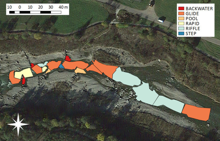
FHARMOR
The FHARMOR project explores new modeling and river survey techniques to improve current habitat simulation and evaluation methodologies. The research objectives are in line with the European Commission “Guidance document on Ecological Flows (Eflows)” for the implementation of the Water Framework Directive, which stresses using information of river habitats (in terms of quality, quantity and distribution) as a metric to quantify the impact of hydromorphological alterations. Furthermore, as defined by Annex V 1.2 of the WFD, biological assessment methods alone are not sufficient to guarantee that hydro-morphological pressures have no significant impact of water body status. This potential flaw of biological indicators is particularly important in Alpine rivers, where biological quality elements may indicate a good status whereas data from hydrological monitoring indicate that the water body is subject to a significant alteration to the natural flow regime.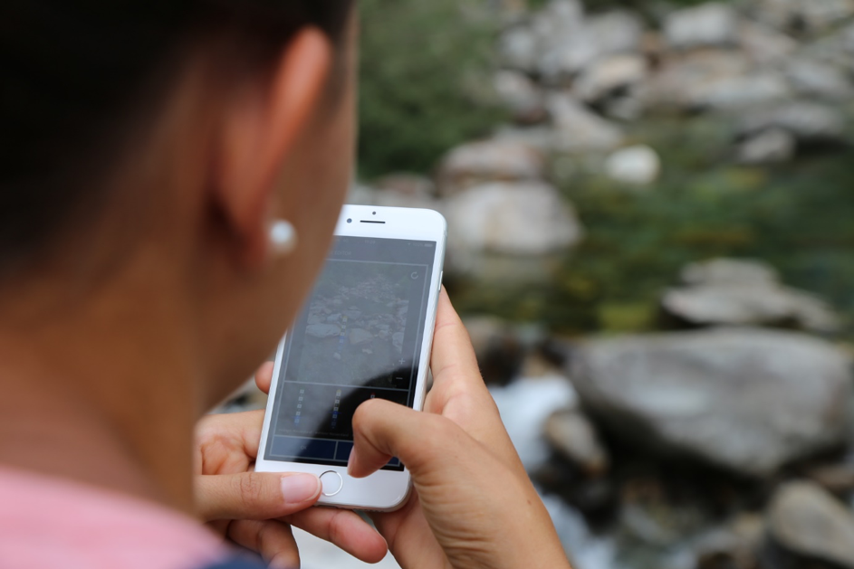
CrowdWater
CrowdWater is a citizen science project to collect hydrological data. No installations or sensors are needed for the measurements. Everyone can set-up a new station and contribute data for already existing stations using the free CrowdWater app (available for Android and iOS). All participants can view the data (including the time series) directly in the app and also request the data.
For stream level class measurements, the user takes a picture and adds a sticker with a virtual staff gauge to the picture. This makes it easy to observe changes in the water level by comparing the current water level to the water level in the picture with the staff gauge in the app.
For the status of intermittent streams six qualitative classes are used: flowing water, trickling water, standing water, isolated pools, wet streambed and dry streambed. The users take a picture of the stream and picks the corresponding category.
The app is currently available in German, French, English and Spanish. So far, almost 1200 CrowdWater stations have been established, and 358 different participants have made more than 3000 measurements. We welcome anyone interested in water to participate in the CrowdWater project!