Explore the map by clicking on the legend
to filter layers by barriers and countries!
Or download all data from the Atlas database and Barrier Tracker citizen science.
When using the Barrier Atlas data please use this citation:
AMBER Consortium (2020). The AMBER Barrier Atlas.
A Pan-European database of artificial instream barriers. Version 1.0
June 29th 2020. https://amber.international/european-barrier-atlas/
The Barrier Atlas
Barriers in European rivers
About the Barrier Atlas
Throughout Europe, there is inconsistent and incomplete data on how many barriers currently exist. Thus, the magnitude of river fragmentation in Europe is almost unknown. An essential first step of the AMBER project was to create an inventory of barriers within European rivers— a Pan-European Atlas of In-Stream Barriers. To date, this map is the most comprehensive overview of available information on barriers in Europe. There are over half a million recorded barriers fragmenting our rivers. However, through field validation, we estimate that there may be well over 1 million barriers in Europe's rivers. For example, it appears as if the only barriers on Sardinia’s rivers are some 53 dams but there could be many more. An additional factor is the state of in-stream barriers, whether they are in use or not; our citizen science phone application has helped to map barriers in many countries, providing preliminary information on the proportion of obsolete and abandoned barriers.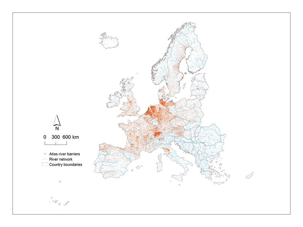
*This is a compilation of 630,000 unique barrier records from existing datasets and the full barrier picture includes at least 400,000 additional barrier points whose locations are being modelled.
How we did it
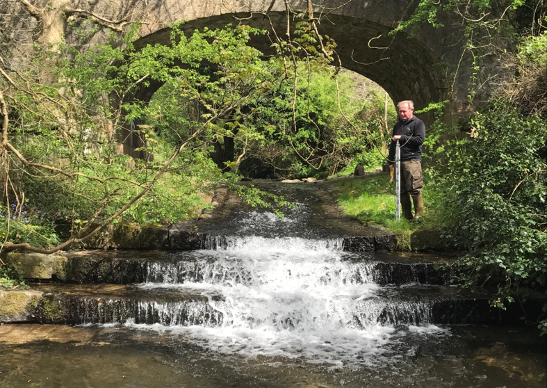
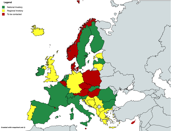
By compiling these data and creating this inventory, AMBER researchers defined a common standard for displaying and validating barrier data. Relevant stakeholders can use this standard for future barrier reporting throughout Europe as, currently, data is not available in a consistent format in many European countries. The combination of these barriers and other impacts are affecting our rivers, but we now have an opportunity to reconnect and restore them. Together with other tools developed by AMBER, these data enable water managers to make informed decisions when prioritizing restoration efforts and planning mitigation measures.Over the past three years, we compiled available data for hundreds of rivers within each of the EU countries. This task required contacting dozens of different organizations responsible for different river basins. From an informal survey conducted in 36 countries, we gathered the picture of currently existing barrier data. The data in this inventory was gathered from local, national, regional, and global databases and includes information on barrier location, type and height. Researchers found that existing data is heterogeneous and is useful in many places, but less clear at others. To ground-truth this data, researchers performed extensive field validations, walking over 1000 km along river banks and beds.
The AMBER researchers believe this is the best estimation of barrier density across Europe possible., based on current data and understanding. With this map, we can better visualize the severity and magnitude of the poor connectivity of Europe’s rivers. The good news is that it can also be used to improve the situation. The data can be used to build models of river fragmentation at various spatial scales that can support water resource managers in making better informed decisions that seek to maximize benefits and minimize barrier impacts on European waters.
The inventory of river barriers from European Member States has helped to build the first picture of river fragmentation in Europe. Unfortunately, the image is alarming—there are hardly any free-flowing rivers in Europe at all!
The Pan-European Atlas of In-Stream Barriers provides the most comprehensive overview of river fragmentation in Europe. It shows Europe has the most fragmented rivers in the world with over 1 million barriers. But more than 10% of these barriers are abandoned or obsolete, according to our citizen science programme. This means that there may be over 100,000 obsolete barriers that could be removed to help reconnect Europe’s rivers. By simply acting on 2.5% of these 25,000 km of rivers could be freed, helping to meet the goals of the new EU Biodiversity Strategy for 2030.
Citizen Science
Everybody can locate barriers in rivers!
The Barrier Tracker app
With the Barrier Tracker app you can help us identify barriers! Using the app helps gather more data and provides greater spatial coverage than would have been possible using conventional surveys. Typical data gathered include a photo of the barrier, the location of the barrier and the height of the barrier. This Barrier Tracker app is part of a larger citizen science program that is needed to help build the barrier ATLAS.

The following organisations all supported the development of the Barrier Atlas.