Case Study Number: 2
River name: Guadalhorce
River extension: 154Km
RIVER surface area: 3,157Km2
AMBER TOOLS: Molecular toolkit (D2.5), Ecosystem Services Survey (D2.7), MesoHABSIM (D2.6), Social survey (D3.5)
River extension: 154Km
RIVER surface area: 3,157Km2
AMBER TOOLS: Molecular toolkit (D2.5), Ecosystem Services Survey (D2.7), MesoHABSIM (D2.6), Social survey (D3.5)
THE NEED
The River Guadalhorce the central fluvial basin of south Mediterranean Spain. It is the longest river in the Andalusian Mediterranean Basin, and the second largest, after the River Guadiaro. The irregular regime alternates between frequent droughts and occasional flash floods that cause extensive damage and threaten human lives. The river supplies electricity to the city of Malaga via four hydropower stations on the same number of dams and reservoirs that also regulate water flow.
Historical studies carried out suggest that the Guadalhorce basin had the presence of indigenous trout (Salmo trutta), which is currently considered extinct in the basin. The population of the Guadalhorce would be among the 11 or 12 native trout populations that would have disappeared in the Andalusian region in the last century, 73% of the total. However, the environmental DNA study carried out by UNIOVI in the Guadalhorce within the AMBER project, has detected the presence of the species in the headwaters of the basin, so it will be necessary to carry out new investigations that allow to confirm it and know its status.
Historical studies carried out suggest that the Guadalhorce basin had the presence of indigenous trout (Salmo trutta), which is currently considered extinct in the basin. The population of the Guadalhorce would be among the 11 or 12 native trout populations that would have disappeared in the Andalusian region in the last century, 73% of the total. However, the environmental DNA study carried out by UNIOVI in the Guadalhorce within the AMBER project, has detected the presence of the species in the headwaters of the basin, so it will be necessary to carry out new investigations that allow to confirm it and know its status.
- Generation of potentially high pressure on the ecological state of the water body by regulating the downstream flow
- Impact on the river’s ecosystem
- Loss of environmental value

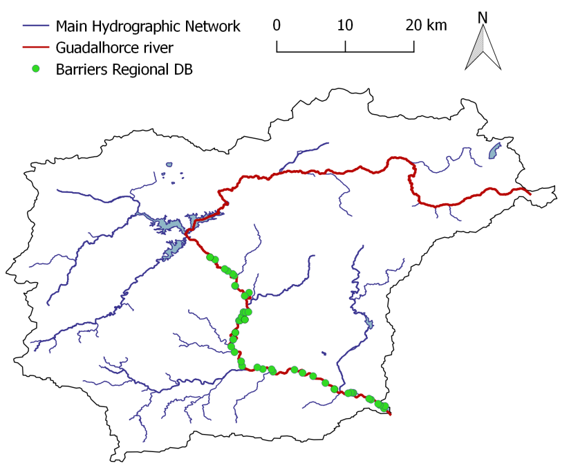
Obstacles registered in a Regional Database for the Guadalhorce basin.
WHAT WE DID
Using the AMBER approach to adaptive management, a multidisciplinary set of tools and actions were carried out. Molecular tools were applied to assess biota richness above and below the current dams and in the reservoirs. A trial of participatory approach, based on the results of a social survey on social acceptance of dams was conducted at this demonstration site. AMBER tools were also employed for estimating ecosystem services as well as for the identification and characterization of mesohabitats and evaluating the accuracy of official databases through field validation of the barriers that block the river. It is expected that the application of the AMBER tools will help with the consideration of different points of view and take these into account, especially river connectivity. This will reduce the potential impact of the new modifications planned in the river when they are constructed.
Before starting to apply AMBER tools, local stakeholders were identified, and contacts established to initiate networking. The objective was to work together following a participatory approach with stakeholder involvement.
Before starting to apply AMBER tools, local stakeholders were identified, and contacts established to initiate networking. The objective was to work together following a participatory approach with stakeholder involvement.
Tools
- Molecular toolkit (D2.5)
- Ecosystem Services Survey (D2.7)
- MesoHABSIM (2.6)
- Social survey (D3.5)

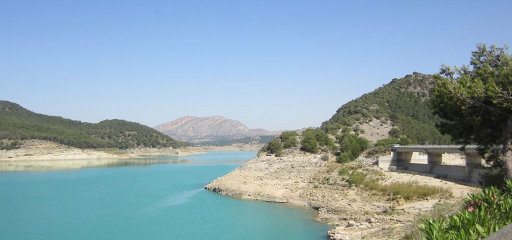
“Conde del Guadalhorce” Dam.
NOW WHAT
The results obtained applying AMBER tools show that the local population is generally favourable to the presence of dams and reservoirs and that these provide valuable ecosystem services in this region. The importance of river connectivity has been highlighted. The differences between better conserved upstream sites and the sites affected by dams that contain more species potentially harmful for humans were presented and discussed. The construction of passages for aquatic organisms to pass the dams and reconnect populations along the River Guadalhorce has been proposed for further discussions. The idea of networking with citizens of other regions affected by dams, for example, the Upper River Nalón, has been proposed for extending AMBER benefits beyond the project life.
AMBER researchers have contributed in this case study to spread the message of AMBER using an interdisciplinary approach that combines environmental analysis, biological study including eDNA and other measures, and a social approach based on participatory management – in this case producing objective data about the real impact on biotic connectivity and the social acceptance of dams, and sharing data and outreach of AMBER results with local stakeholders and public. The results of this case study will help to give more value to aquatic ecosystems and river connectivity in dry European landscapes such as Mediterranean basins.
AMBER researchers have contributed in this case study to spread the message of AMBER using an interdisciplinary approach that combines environmental analysis, biological study including eDNA and other measures, and a social approach based on participatory management – in this case producing objective data about the real impact on biotic connectivity and the social acceptance of dams, and sharing data and outreach of AMBER results with local stakeholders and public. The results of this case study will help to give more value to aquatic ecosystems and river connectivity in dry European landscapes such as Mediterranean basins.

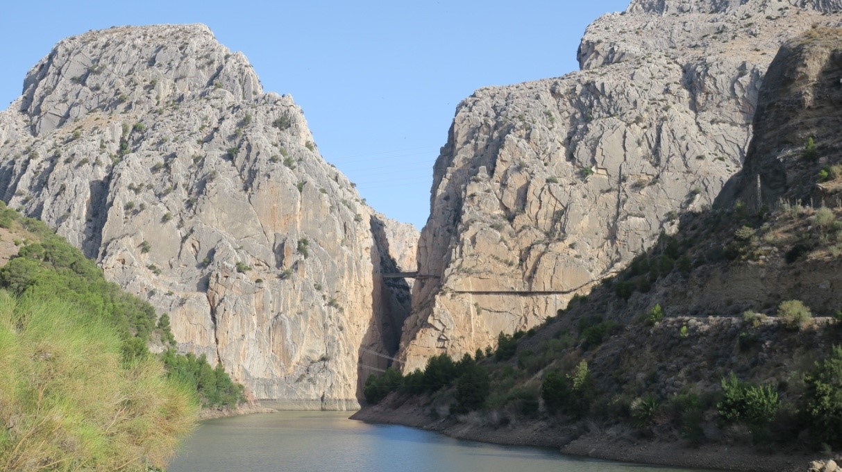
Los Gaitanes Gorge.
WHO WAS INVOLVED
Junta de Andalucia (Regional Government of Andalusia); EU H2020 project SWOS -Satellite- based Wetland Observation System; NGO ‘Ecologistas en Accion’; NGO SEO-Birdlife; University of Malaga, Center of Hydrogeology and European Topic Center (Dr Dania Abdul Malak, researcher Christoph Schröder). In the Junta de Andalucia, the following Services and persons were contacted: Subdirección de Explotación, José Manuel Puerto Gisbert; Servicio DPH y Calidad De Aguas de la Delegación Territorial de Medio Ambiente, Oscar Alberto Lorente Castellano; Subdirección General de la Demarcación Hidrográfica del Sur, Fernando Ferragut.
FURTHER READING
References
Benejam, Ll. 2008. Fish as ecological indicators in Mediterranean freshwater ecosystems Ph.D. Thesis.
Cimarelli, L., Singh, K. S., Mai, N. T., Dhar, B. C., Brandi, A., Brandi, L., & Spurio, R. 2015. Molecular tools for the selective detection of nine diatom species biomarkers of various water quality levels. International Journal of Environmental Research and Public Health, 12(5), 5485–5504.
Doadrio, S. Perea, Garzon-Heydt, P. & Gonzales, J. L. 2011. Ictiofauna continental española. Bases para su seguimiento. Madrid: Ministerio de Medio Ambiente y Medio Rural y Marino, D. G. Medio Natural y Política Forestal.
Gavira, O. & Garrido, S. 2019. Some notes on the river ecology of the Guadalhorce River. Symposium on connectivity in Mediterranean Rivers – AMBER project. September 2019.Gawne, B., Capon, S.J., Hale, J., Brooks, S.S., Campbell, C., Stewardson, M.J., Grace, M.R., Stoffels, R.J., Guarino, F. & Everingham, P. 2018. Different conceptualizations of river basins to inform management of environmental flows. Frontiers in Environmental Science. https://doi.org/10.3389/fenvs.2018.00111
Herrera Grao, T. (editor.) 2008.
Evaluación de los ecosistemas, grado de estado ecológico de las aguas y valores histórico-patrimoniales de Río Grande (Málaga) y campaña educativa, de divulgación y sensibilización ciudadana de sus valores. Málaga: Informe elaborado para la Fundación Nueva Cultura del Agua.
Junta de Andalucía. 2009. Memoria: Plan Hidrológico de la Demarcación Hidrográfica de las cuencas mediterráneas andaluzas. 343 pp.
Jábega Magazine No. 1 (1973) Edition Center of the Diputación de Málaga.
Rivera, S. F., Vasselon, V., Jacquet, S., Bouchez, A., Ariztegui, D. & Rimet, F. 2018. Metabarcoding of lake benthic diatoms: from structure assemblages to ecological assessment. Hydrobiologia, 807(1): 37-51.
Sáez Gómez, P. 2010. Análisis de la distribución histórica de la trucha común (Salmo trutta, Linnaeus, 1758) en Andalucía. Revista Ríos con Vida nº 85. Pp 16-19. Madrid.
Toro, M., Robles, S., Tejero, I., Cristóbal, E., Velasco, S., Sánchez, J.R. & Pujante, A. 2009. Grupo 32. Tipo Ecológico Nº 7. Ríos mineralizados mediterráneos de baja altitud. En: VV.AA., Bases ecológicas preliminares para la conservación de los tipos de hábitat de interés comunitario en España. Madrid: Ministerio de Medio Ambiente, y Medio Rural y Marino. 14 pp.


