Results of the field validation in Spain: 100 obstacles in 100 km of rivers

River fragmentation and barrier assessment methods in Ireland: Research Seminar day by Inland Fisheries Ireland
January 3, 2018
Barrier Tracker app will be translated into 9 languages
January 11, 2018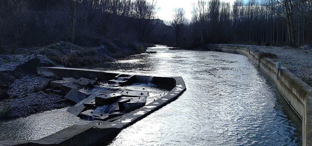

Results of the field validation in Spain: 100 obstacles in 100 km of rivers
During the past 4 months, September to December 2017, AEMS-Rios con Vida in collaboration with the Universidad de Oviedo (UNIOVI) have performed the field validation in Spain. 100 km of river length were surveyed in 5 different rivers, representative of a wide range of river conditions within the country. The aim of this task is to record all transversal barriers that hinder the connectivity of the selected streams in order to validate, through field surveys, the existing barrier databases and assess the quality of river barrier monitoring. The Spanish team explored 5 representative sections (figure 1), 20 km each, in rivers Alberche (Tagus River Basin District), Guadajoz (Guadalquivir River Basin District), Guadalhorce (Andalusian River Basin District),Nalón (Cantabrian River Basin District) and Tirón (Ebro River Basin District). The selection of rivers and sections along each river follows the homogenizing criteria for field surveys provided in advance by Politecnico di Milano (POLIMI). The main criteria, that seeks to represent the variability of the Spanish hydrographic network, focuses the selection considering the type of river, the altitude, the slope, the sinuosity and finally the land use.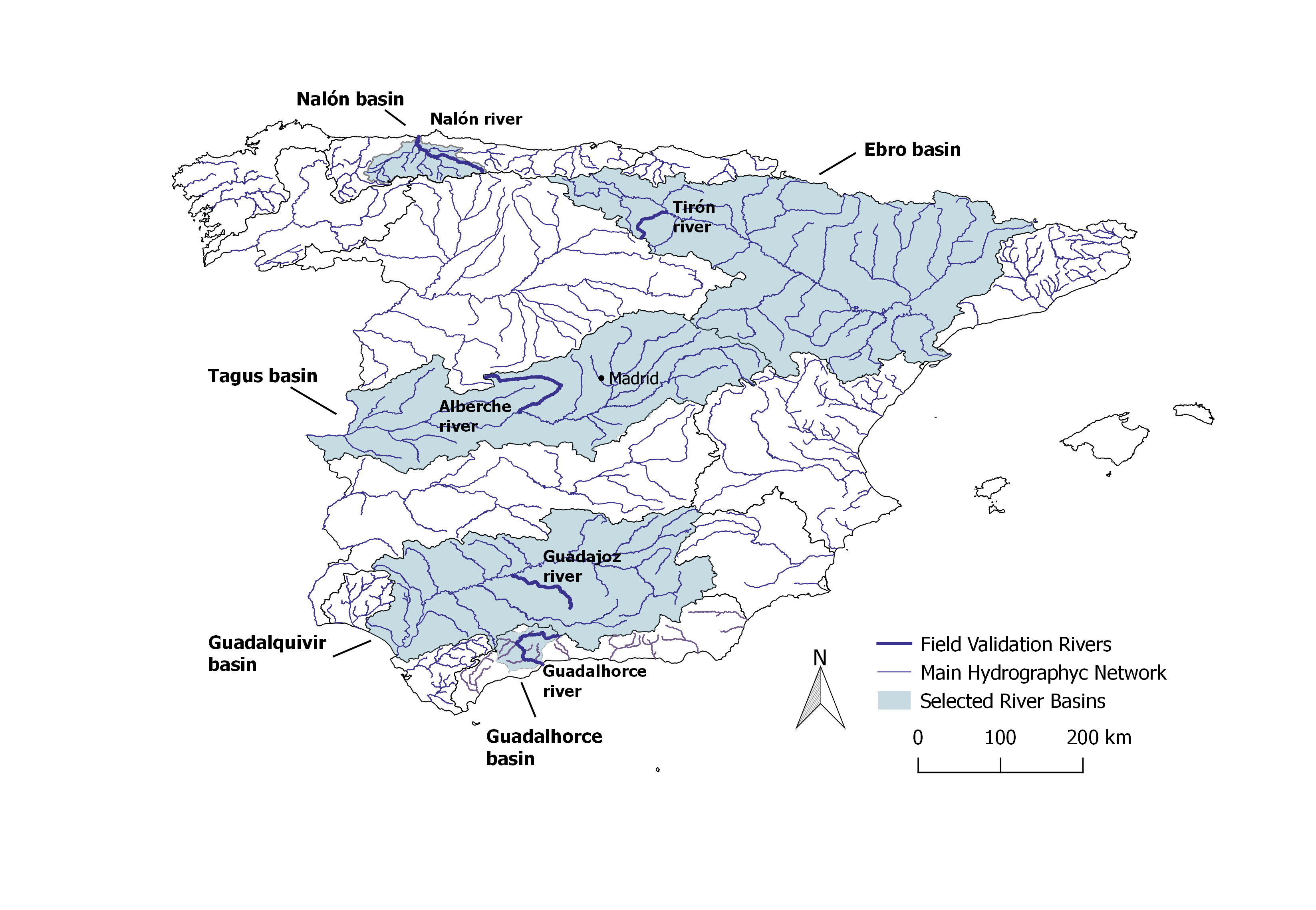
Figure 1. Location of the five selected rivers and sites for field validation in Spain
A preliminary analysis of the data reveals a total of 100 obstacles recorded along the 100 kilometres of field reach, 17% of which were not functioning. It is important to highlight that only 2 over the total had a fish passage device yet apparently non functional or poorly effective. In both cases these structures are steps of scale, designed to facilitate the passage of fish yet only in their movements of ascent, with inadequate characteristics and therefore probably ineffective.
The most common barrier founded is the weir (total of 68 weirs), followed by the ramps (total of 20 ramps most of them in urban areas). The 46% of barriers are between 0.5 and 1 meter height, and 3 dams were found at Alberche, Guadalhorce and Nalón River. The highest density of barriers was found at the field reach along the Nalón River, with 62% of barriers of which 46 are weirs and 15 are ramps. The next step of the analysis is to check the data using the existing databases of each basin district in order to reveal discrepancies, assess databases accuracy and the quality of barrier monitoring programs.
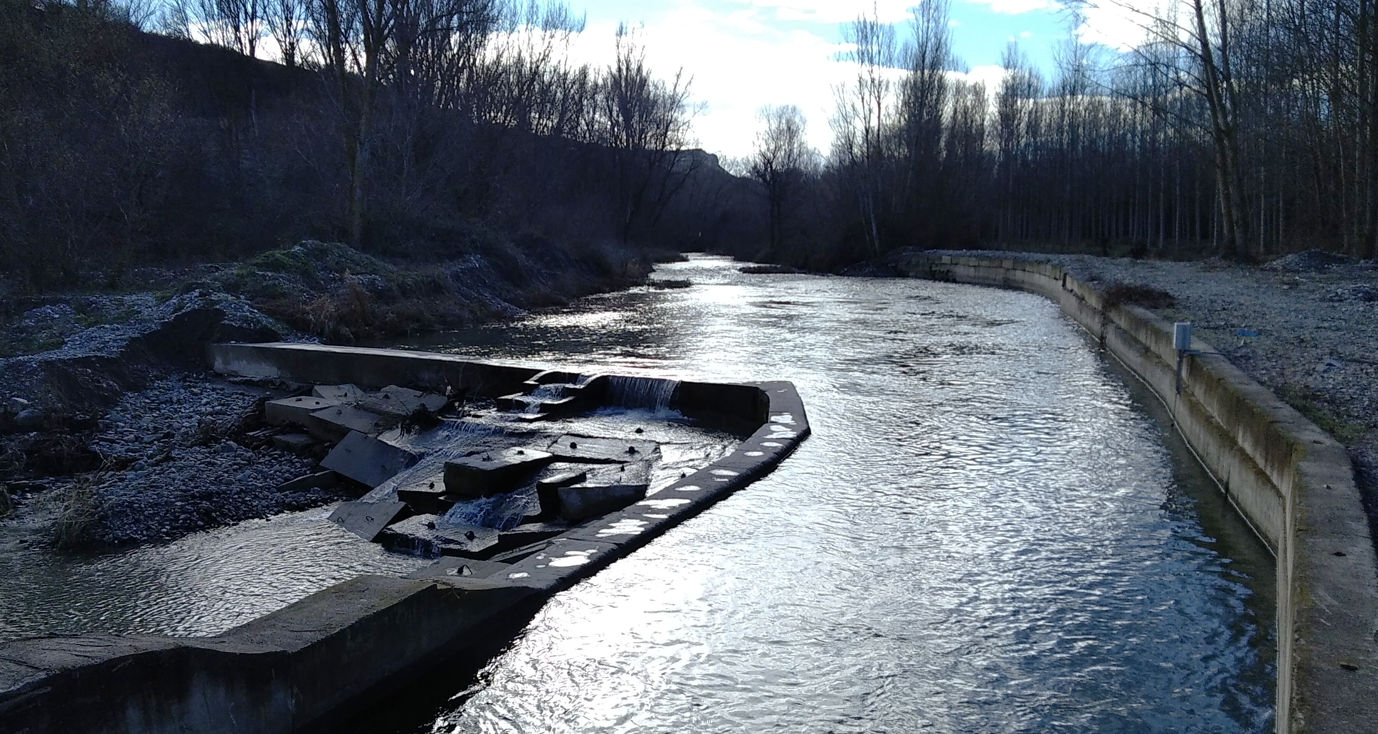
Obstacle located in Spain. River Tirón (Ebro river basin district)
The field validation approach is needed in order to generate a consistent ATLAS of barriers across Europe and to estimate the quality of such mapping, the degree of barrier underestimation in each country, and highlight priorities and good practices for future barrier reporting in Europe.
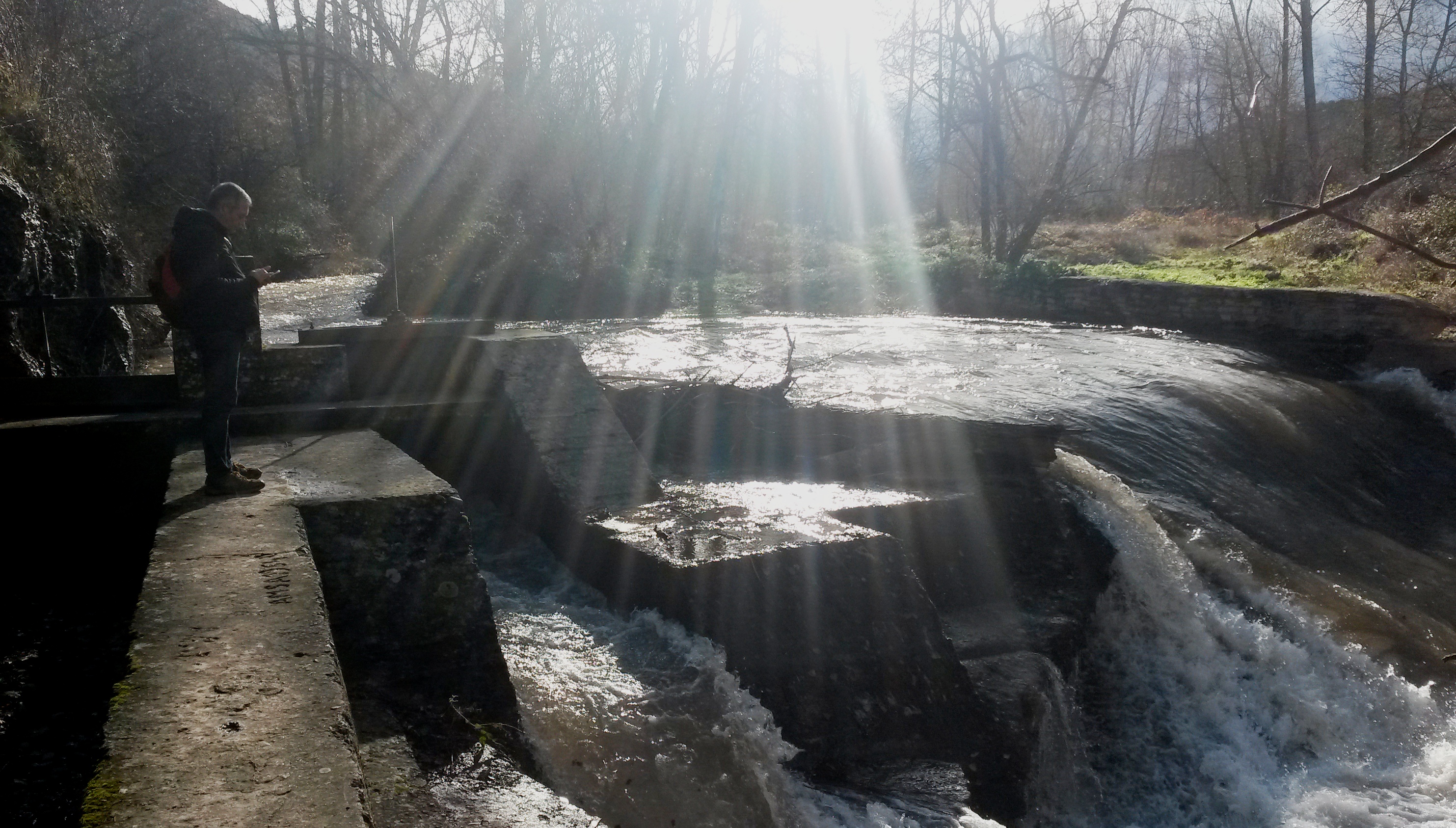
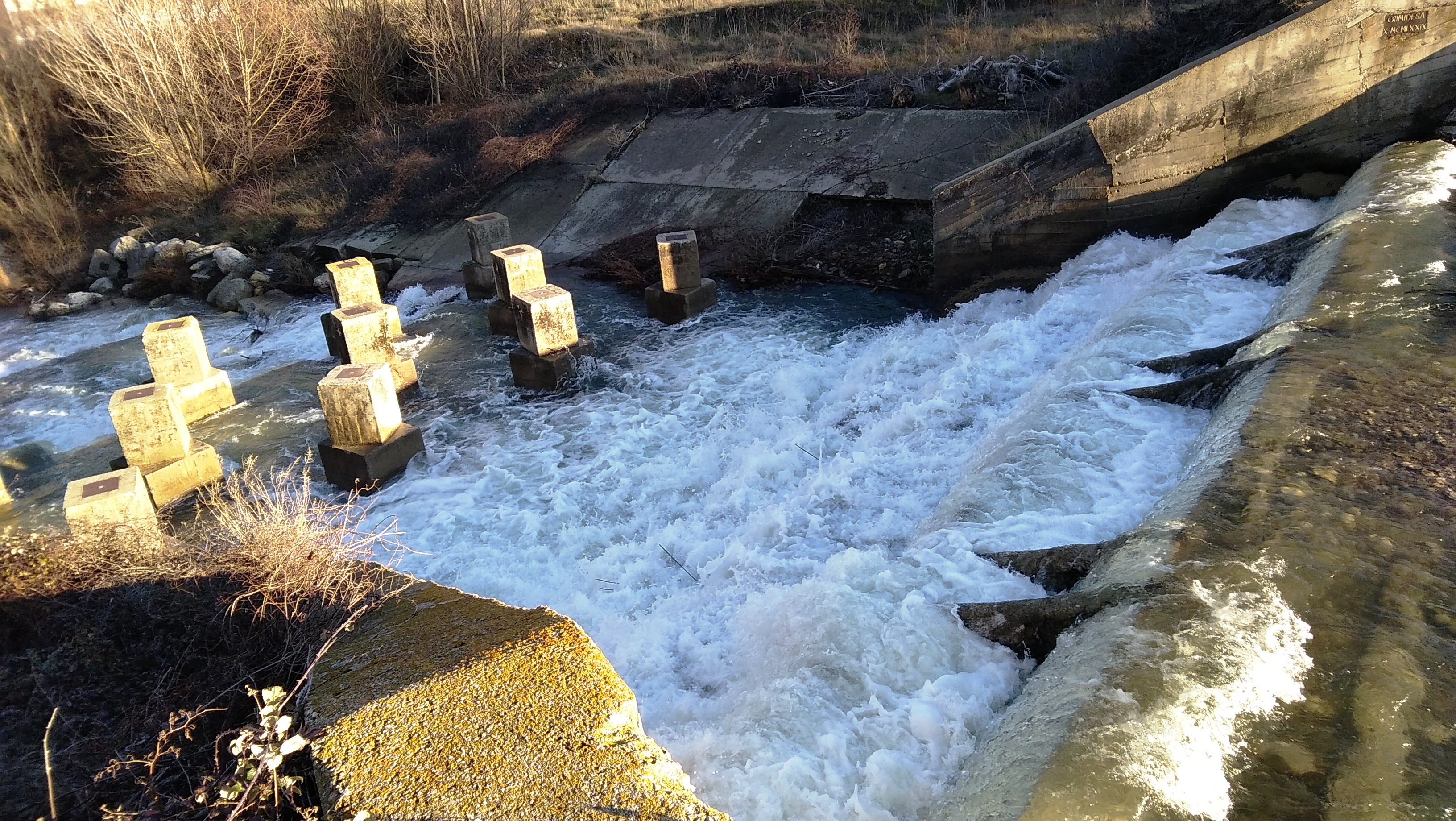
Obstacle located in Spain. River Tirón (Ebro river basin district)
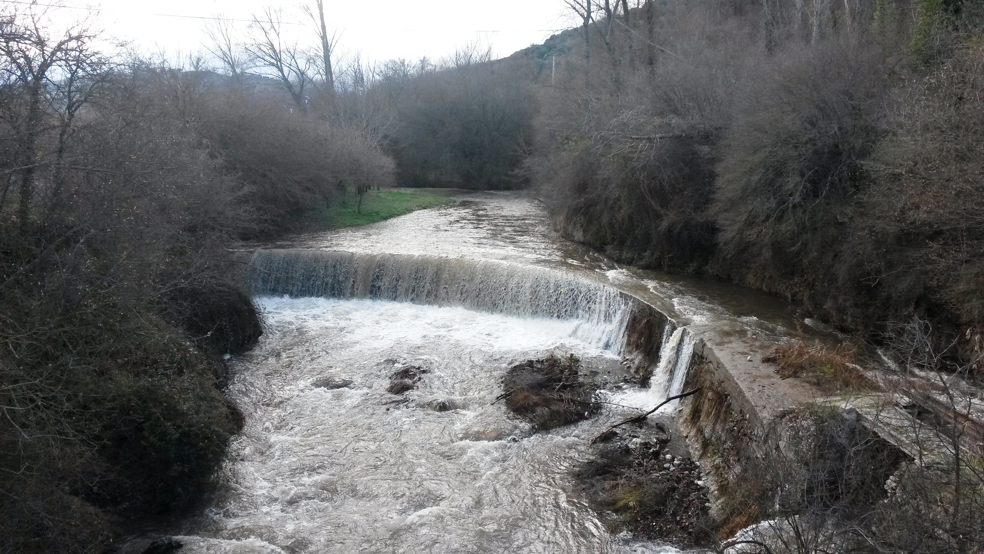
Obstacle located in Spain. River Tirón (Ebro river basin district)
Obstacle located in Spain. River Tirón (Ebro river basin district)
Related posts

October 12, 2022
